Sunday, June 13, 2010

Newest Data From The Tropics

Looking at the latest computer data, there is still a lot of agreement with the speed and direction of the system in the Atlantic. It should continue to move WNW towards the Windward Islands over the next few days.


On the flip side, computer forecasts are all over the place with the strength of this thing.


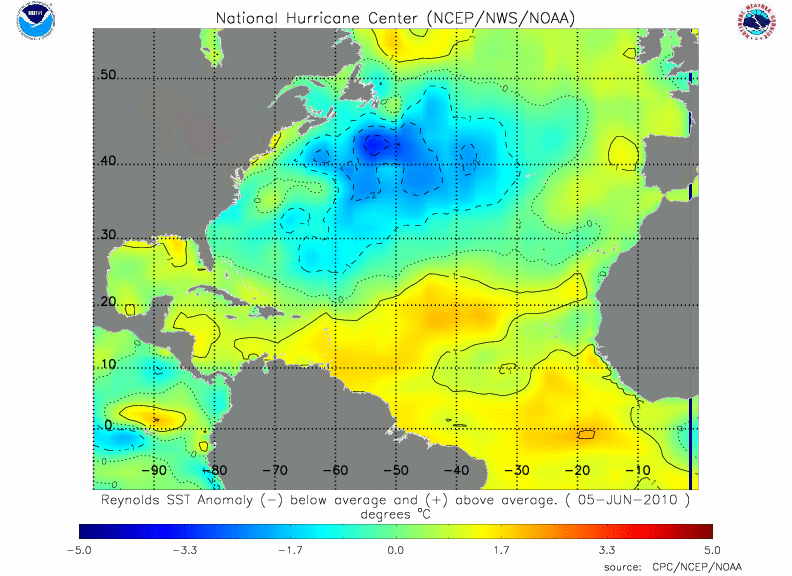
Water temperatures are very warm in this region, and wind shear isn't too strong. I think we should see this system strengthen over the next couple days and possibly become Alex.

A broad area of convection (thunderstorms) continues to slowly organize in the central Atlantic. Water temperatures are very warm in this region, however, wind shear is still moderately high, which is temporarily inhibiting the development of this system.


Most of the computer forecasts have this system strengthening over the next 48 hours as it drifts slowly westward.


If this trend continues, we will have our first named storm of the season - Alex. We will be tracking this closely through the week and will bring you more updates!

Thursday, June 10, 2010

El Nino Update

El Nino ended in May across the Equatorial Pacific with ENSO-neutral conditions now. Not only have sea surface temperatures fallen into the neutral range, they continue to fall and will likely be within La Nina conditions this Summer. Many of the computer model forecasts are beginning to agree that La Nina will settle in this Summer and continue the rest of the year. The NCEP CFS forecast is the heavy blue line:
It is not always the case, but there has been some research to indicate that the Atlantic Hurricane Season is enhanced during La Nina events. Last year's hurricane season confirmed the opposite, that during an El Nino year Atlantic hurricane activity is suppressed. We are already calling for an above-average hurricane season as a result of warmer-than-average sea surface temperatures in the Atlantic, and with the additional support of low wind shear from La Nina we should be on track for an active season.

Right now, tropical activity is low in the Gulf, Caribbean, and Atlantic Basin, but we will be monitoring for any developments!
(Visible satellite image 6/10/10 at 8:15 AM EDT)