Monday, April 26, 2010

Race Doubleheader Forecast


Racing is back in Richmond this weekend with a doubleheader Friday and Saturday nights, both races starting at 7:30 PM. At this time, it looks like both days will be dry and warm (Friday's High: 79, Saturday's High: 84) as a strong ridge of high pressure will be in place from the Southeast to the Mid-Atlantic at the end of this week. Here's the upper-level map showing the ridge Friday evening:
But you can also clearly see the large low pressure system over the Plains at the end of this week, too. That's the system we expect to reach the East Coast by Sunday. However, if this system moves a little faster and the ridge weakens or shifts farther east, the rain may move into Central Virginia by Saturday afternoon. The timing of this system will be closely watched for its potential impacts on Saturday's Heath Calhoun 400. Check back here for updates on the forecast!

Sunday, April 25, 2010

Weather Update - 4:00 PM

Clouds are starting to break apart across the region this afternoon, which will allow the sun to heat us up. The atmosphere is already unstable, so this will only add fuel to the fire. The upper-level storm system continues to churn to our west and will eventually bring enough "lift" to create a few thunderstorms this afternoon and evening. Storms will be widely scattered, so not everyone will see the rain. However, any storms that develop could quickly become severe, so we will be tracking this very closely over the next several hours. It looks like the threat for severe weather will quickly diminish after midnight tonight.

Saturday, April 24, 2010

Severe Threat Sunday

Strong southwesterly winds will bring warm and humid air into our area.


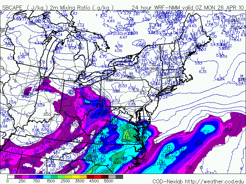
This will increase instability in the atmosphere, which is measured by CAPE.


A strong jet max (area of strong winds) will move in during tomorrow afternoon and provide "lift" in the atmosphere. It will also bring in speed shear (winds increasing with height). This means that some isolated thunderstorms could develop rotating updrafts.


Tonight's batch of rain will exit the region early tomorrow morning. Widely scattered thunderstorms will then develop in the early afternoon and last into the evening. Some of these storms could quickly become severe with damaging winds and large hail. In addition, a brief tornado could also develop, however, I'm not expecting anything like what they saw in Mississippi today.

We will be tracking this through the day tomorrow and will bring you the very latest!