
Thursday, May 27, 2010
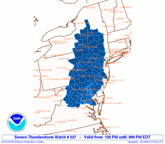
Severe Thunderstorm Watch - Thursday 5/27
A Severe Thunderstorm Watch has been issued until 9 PM for the northern third of Virginia. Upper level winds will steer storms almost straight south, so we should see thunderstorms headed into parts of central Virginia later this evening and into tonight. Large hail and strong winds will be the primary threat with these storms.


Risk for Severe Storms
Strong to severe thunderstorms may develop this afternoon to our North as a cold front makes its move south, creating a cluster of storms that may track all the way into Northern Virginia and into the Northern Neck and Middle Peninsula late this afternoon and evening. Hence, we have a slight risk for this part of the state:

We could also see isolated afternoon storms develop anywhere in Central Virginia today with peak afternoon heating and humid conditions, and those could also be quite strong. That same approaching cold front on Friday could enhance thunderstorm chances in the afternoon and evening as it tracks into Virginia. It looks like most of us will have a good chance for rain and storms Friday, and some of these storms could be severe with damaging winds and large hail:

Showers may stick around Saturday, too, with mostly cloudy skies, but by Sunday we should be dry and warmer in the 80's.

We could also see isolated afternoon storms develop anywhere in Central Virginia today with peak afternoon heating and humid conditions, and those could also be quite strong. That same approaching cold front on Friday could enhance thunderstorm chances in the afternoon and evening as it tracks into Virginia. It looks like most of us will have a good chance for rain and storms Friday, and some of these storms could be severe with damaging winds and large hail:

Showers may stick around Saturday, too, with mostly cloudy skies, but by Sunday we should be dry and warmer in the 80's.
Wednesday, May 26, 2010
Surf's Up

As a result of the non-Tropical low pressure system spinning about 450 miles Southeast of North Carolina's coastline, gale force winds, high waves and rough surf are being kicked up from South Carolina to Virginia. Offshore, seas are up to 14 feet. At our beaches in Virginia, waves are up to 8-9 feet along the coast right now. These waves are expected to subside over the next couple of days, but if you're headed out to the beach today for an early start to the holiday weekend, be aware of the rough wave conditions. This low is still not showing signs of becoming sub-tropical, so it will likely weaken and drift northeast over the next couple days.
Subscribe to:
Posts (Atom)