Sunday, May 17, 2009

Update On The Tropics

I just got done looking at the latest data, and it still looks like a low pressure will develop off the western coast of Florida early Wednesday.


There will be an upper-level circulation associated with this low so it will not start as a tropical system. In addition, it will be completely cut off from the jet stream (which will be all the way in Canada), so it will have an erratic track.
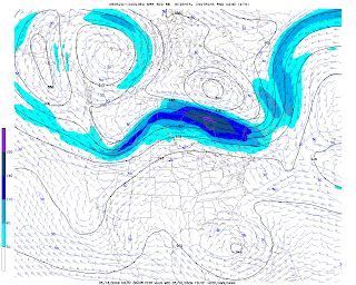


However, if this low continues to drift into the warm waters of the Gulf Of Mexico, then it could begin to develop more tropical characteristics (i.e. become a sub-tropical or tropical storm). A lot can change in the coming days, but we will continue to monitor this closely because it could become the first named storm of the season...Ana.

Talk About Opposites...

While we are dealing with chilly weather here across the Mid Atlantic, it is a different scenario out West, where they are in the midst of a heat wave!

Weekend Rain Totals

Although rain totals for Richmond and Petersburg were roughly around a half inch, amounts were much more impressive elsewhere. Check out the totals for some of our western communities - Doppler estimates are anywhere from 2 to possibly 5" for Orange, Albemarle and Buckingham counties!

Showers Persist This Morning

Showers and an occasional downpour will be possible this morning. Showers will become more isolated in the afternoon, so today will not be a complete washout. We will then be completely dry in the evening.