

Sunday, June 13, 2010
Newest Data From The Tropics
Looking at the latest computer data, there is still a lot of agreement with the speed and direction of the system in the Atlantic. It should continue to move WNW towards the Windward Islands over the next few days.

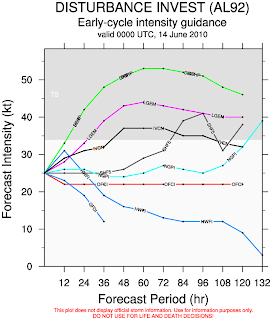
On the flip side, computer forecasts are all over the place with the strength of this thing.
Water temperatures are very warm in this region, and wind shear isn't too strong. I think we should see this system strengthen over the next couple days and possibly become Alex.


On the flip side, computer forecasts are all over the place with the strength of this thing.

Water temperatures are very warm in this region, and wind shear isn't too strong. I think we should see this system strengthen over the next couple days and possibly become Alex.
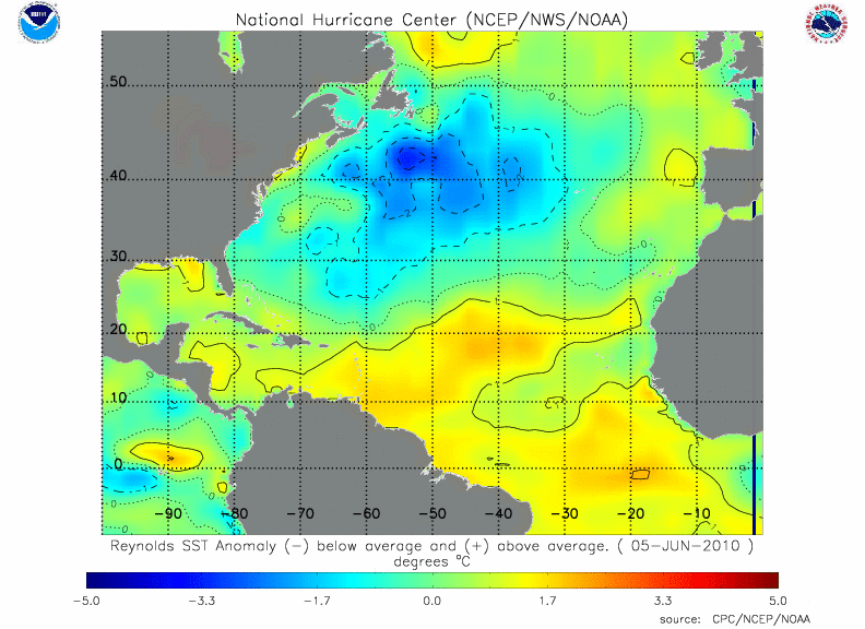
A broad area of convection (thunderstorms) continues to slowly organize in the central Atlantic. Water temperatures are very warm in this region, however, wind shear is still moderately high, which is temporarily inhibiting the development of this system.
Most of the computer forecasts have this system strengthening over the next 48 hours as it drifts slowly westward.


If this trend continues, we will have our first named storm of the season - Alex. We will be tracking this closely through the week and will bring you more updates!
Most of the computer forecasts have this system strengthening over the next 48 hours as it drifts slowly westward.


If this trend continues, we will have our first named storm of the season - Alex. We will be tracking this closely through the week and will bring you more updates!
Subscribe to:
Comments (Atom)